A New Look at Hantu's Reefs
 August 1, 2013
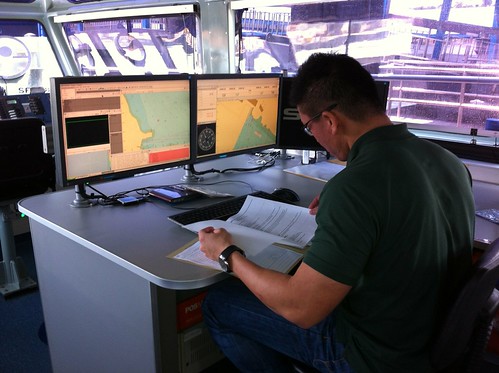
This afternoon we made a very special kind of visit to Pulau Hantu. We left our dive equipment at home and I wore shoes instead of flip flops. It was going to be a dry day, but it surely was not going to be any less exciting. I joined the Maritime Port Authority on board their tricked up vessel, Linta Discovery, to return to the Hantu’s southern slope as they investigate the incident we reported last weekend of the massive marine debris we encountered while diving. Above: Surveyors prepare their machines for the site visit, and I was surprised to find that the folder they had in their hands included a print out of our blog post with our photos for reference!
<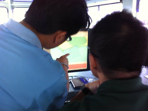
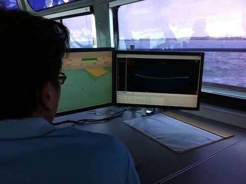
I was instantly stoked when I boarded their vessel at Pasir Panjang Ferry Terminal, wide-eyed at the impressive array of equipment our surveyors use every day to monitor our ocean floor. Above: Surveyors plot the scan pattern as we make our way towards the island.
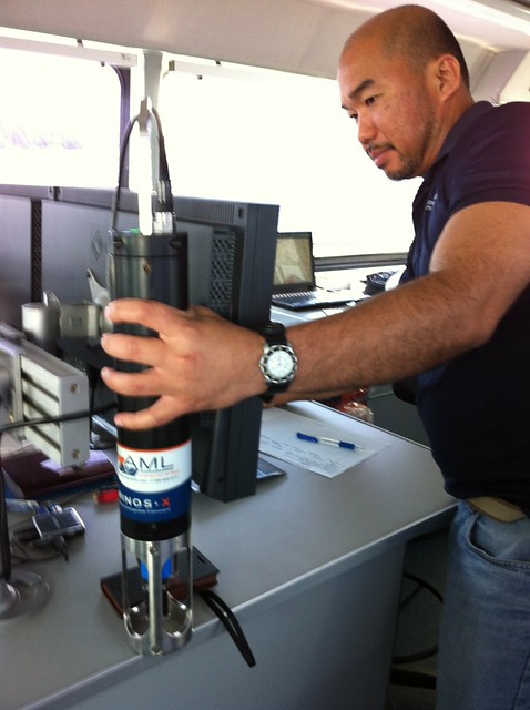
Thomas assigns the Sound Velocity Profiler to the system that works in sync with the sonar to cancel out refraction. Such a cool piece of equipment. I was too slow to capture the image this profiler conjured as it was immersed in the water. But it spat out a wicked graph that showed us the varying refraction rates of the water column due to varying temperature and density levels. When I saw the graph from it, it became so obvious, the channels of water within the water column. I thought to myself: so the marine life can “see” and feel all this but its all invisible to us.
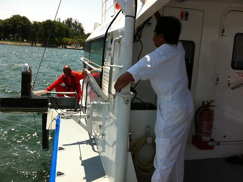
As we pull up along Pulau Hantu, the crew prepare to lower the Multibeam echosounder into Hantu’s waters. I was assured no fish would be harmed, as the pings are adjusted to a low 3 decibels.
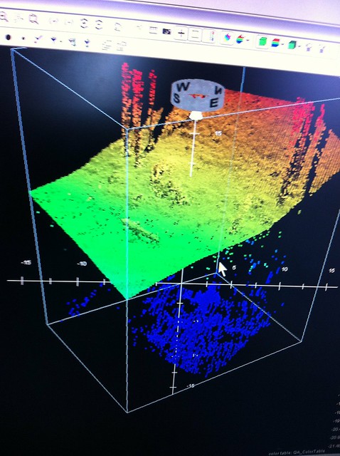
We have a first look at the cross sectional contours of the reef
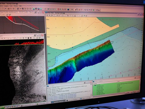
The system begins to plot the contours of the reef on the south side of Pulau Hantu
<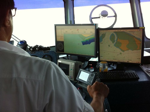
I got to see another view of Hantu’s reefs and it was such a learning experience to watch these guys work! The Linta Discovery is out at sea scanning Singapore waters 5 days a week to make sure ships have lots of space to manoeuvre in and out of our busy ports. It is also on call 24/7 for emergency rescue and salvage operations.
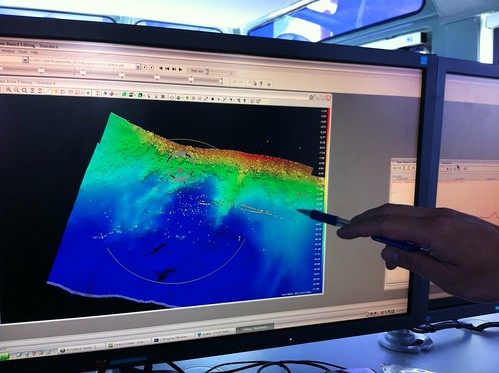
The graphs and charts look like Greek to me but the guys are pointing at pixels and going “that’s it!”
So here’s the jetty. We see the rebar and some of the older pillars. Assuring the guys not to remove the old pillars.
NParks was also consulted since the debris at Pulau Hantu has impacted the reef. It was encouraging to see the agencies collaborating.
Now we sit tight for surveyors to crunch the data and perhaps plan for sensitive salvage of debris from Pulau Hantu. Volunteers may get to join the pros!
To see more photos from this survey, visit the Hantu Blog Gallery!
 Posted in Blog Log

 content rss
COMMENTS